Local guide

Santa Marta from Musa.

What you can do from the front door: on foot, a short taxi away, or with an early start for a full day. Approximate distances from the house, useful tips and where to check opening hours before you go.

Musa's compass Schematic: true directions from Musa, compressed distances. Caribbean Sea on foot short taxi full day N 1 2 3 4 5 6 7 8 9 10
Schematic: true directions from Musa, compressed distances.

Musa's compass.

Every dot sits in its true direction from the house; distances are compressed so everything fits, from Ziruma to the Lost City.

  1. Ziruma trail
  2. Historic centre · Parque de los Novios · Tairona Gold Museum
  3. The bay & the Camellón
  4. El Rodadero
  5. Playa Inca Inca
  6. Quinta de San Pedro Alejandrino
  7. Taganga
  8. Minca
  9. Tayrona National Park
  10. The Lost City (Teyuna)

Approximate distances and times (OpenStreetMap routes, no traffic).

On foot from Musa

Walk out, and be back for a dip.

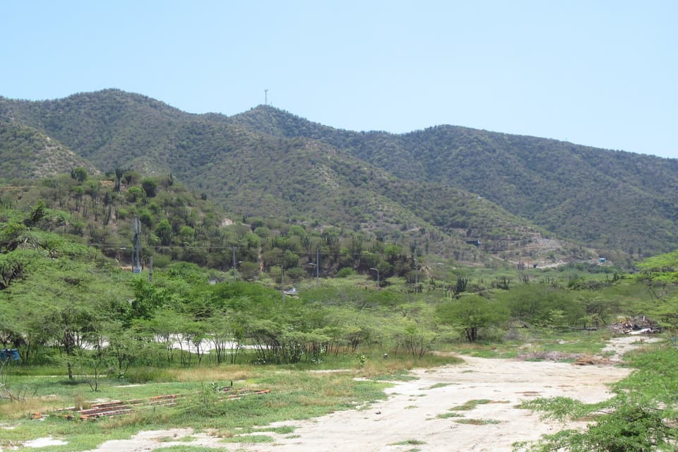
Cerro Ziruma, a dry-forest hill between the bay and El Rodadero.

Photo: Felipe Restrepo Acosta · CC BY-SA 4.0 · Wikimedia Commons

1 Trail and viewpoints

Ziruma trail

6-min walk to the north entrance, on Carrera 4 itself

A boardwalk-and-paving footpath climbing Cerro Ziruma, the dry-forest hill between the bay and El Rodadero, with viewpoints over the city and the sea. Its north entrance is on Carrera 4, about six minutes from Musa, and the path carries on down to El Rodadero: about 3.8 km from the house.

Best time: Sunrise or sunset

  • Go at sunrise or in the last hour before sunset: it's exposed and hot.
  • Bring water. If you carry on to El Rodadero, a taxi back takes about 6 minutes.

Heads-up: We found no official hours: avoid walking it alone after dark.

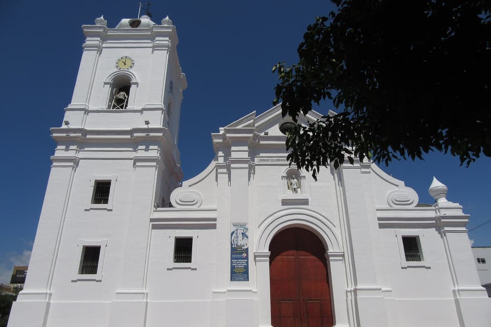
The white façade of Santa Marta's Cathedral Basilica.

Photo: Felipe Restrepo Acosta · CC BY-SA 4.0 · Wikimedia Commons

2 Cathedral, squares and pedestrian streets

Historic centre

18-min walk to the Cathedral

Santa Marta's colonial grid, between the bay and Carrera 5. The white Cathedral Basilica, built from the 1760s, holds the remains of founder Rodrigo de Bastidas; a few blocks away Parque Bolívar opens onto the sea and Calle 19 is a pedestrian street lined with restaurants.

Best time: Early morning or late afternoon

  • Walk early or after 4 pm: highs sit around 31–34 °C all year.
  • Chain it with the Gold Museum and Parque de los Novios.
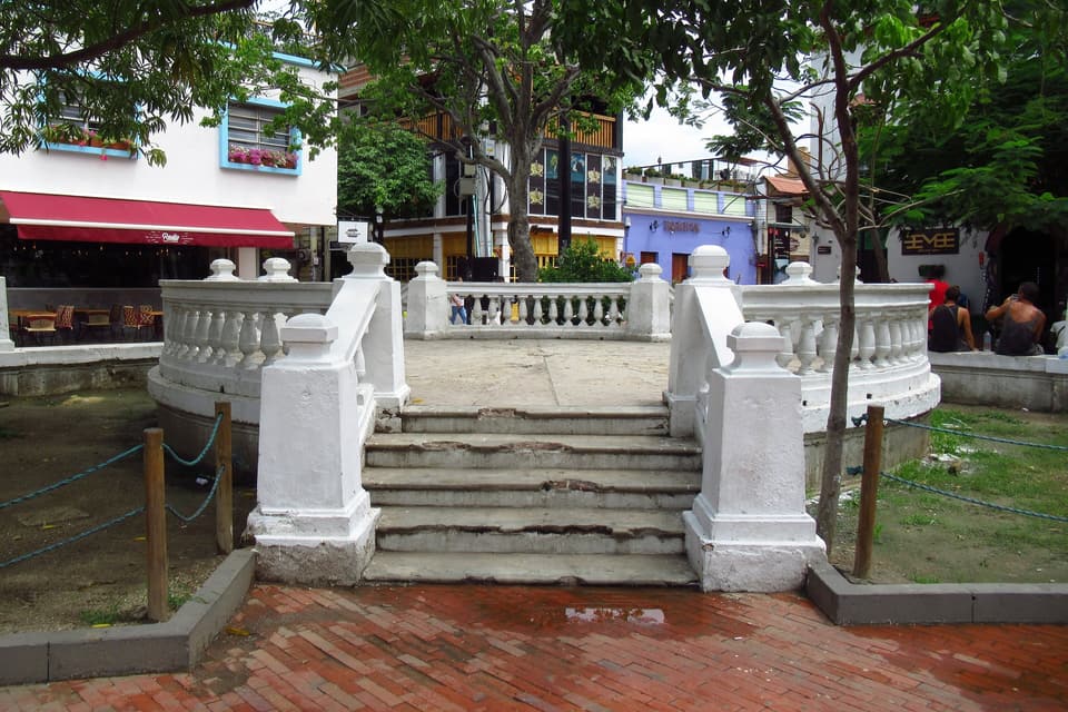
The rotunda of Parque de los Novios, framed by trees and restored houses.

Photo: Felipe Restrepo Acosta · CC BY-SA 4.0 · Wikimedia Commons

2 A square for dinner

Parque de los Novios

18-min walk

A small, tree-shaded square with a rotunda at its centre, ringed by restored houses that are now restaurants and bars. It began as a market square and is now the centre's favourite spot for dinner.

Best time: Evening

  • Best at night: eat outdoors and walk back, or take a 2-minute taxi.
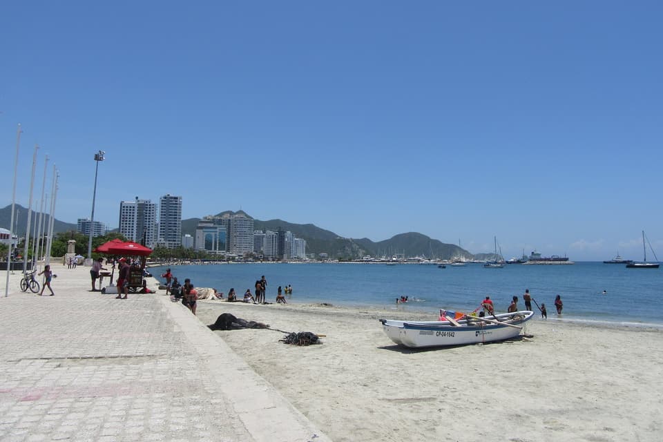
The Bay of Santa Marta from the north end of the Rodrigo de Bastidas promenade.

Photo: Felipe Restrepo Acosta · CC BY-SA 4.0 · Wikimedia Commons

3 Seafront promenade and marina

The bay & the Camellón

20-min walk to the Marina

The Camellón Rodrigo de Bastidas is the palm-lined promenade along the city beach, with Santa Marta's marina at its southern end and the Sierra Nevada behind. It's the classic sunset stroll: the bay faces west.

Best time: Sunset

  • Arrive an hour before sunset and finish in the centre, a block inland.

Heads-up: It's an urban beach beside the port: we found no current official bulletin on swimming-water quality.

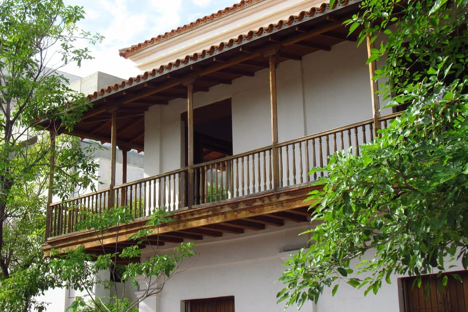
The great wooden balcony of the Casa de la Aduana, home of the Museo del Oro Tairona.

Photo: Felipe Restrepo Acosta · CC BY-SA 4.0 · Wikimedia Commons

2 Casa de la Aduana · Banco de la República

Tairona Gold Museum

22-min walk, on Parque Bolívar

Banco de la República's museum fills the Casa de la Aduana, built in 1730 and one of the oldest buildings in the centre. It holds around 565 pieces: goldwork and archaeology from the Sierra Nevada and ethnographic objects from today's Indigenous peoples.

Best time: Midday

  • Perfect for the hottest hour. Check opening hours and admission on the official site before you go.

A short taxi ride

Beaches, a fishing village and history, under 20 minutes away.

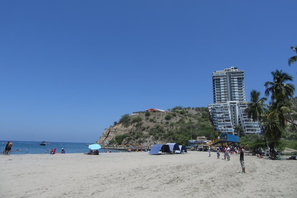
El Rodadero's main beach with apartment towers behind.

Photo: Felipe Restrepo Acosta · CC BY-SA 4.0 · Wikimedia Commons

4 The city's big beach

El Rodadero

6 min by taxi · or a 51-min walk over the Ziruma trail

Santa Marta's best-known beach: a long sweep of sand backed by towers, south of Cerro Ziruma. Boats leave from the shore for quieter coves such as Playa Blanca and Inca Inca.

Best time: Weekday mornings

  • Quietest on weekday mornings.

Heads-up: It gets crowded at weekends and in high season; check the flags before swimming.

A view from the trail down to the small bay of Playa Inca Inca.

Photo: Joseeem · CC0 · Wikimedia Commons

5 A hidden cove

Playa Inca Inca

Taxi to the end of Carrera 5 in El Rodadero + 30 min on an unpaved track, or a boat from Rodadero

A small, quiet beach on the Ziruma headland, between the bay and El Rodadero. You reach it on foot along an unpaved track over the hill from the north end of El Rodadero, or by boat. The house has organised sunrise treks here.

Best time: Sunrise

  • Bring water and cash: services are minimal.
  • Go early, before the heat and the boats.

Heads-up: There's no official information on the track; local press advises going as a group.

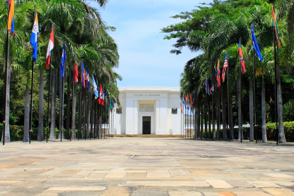
The avenue of flags leading to the Altar de la Patria at the Quinta de San Pedro Alejandrino.

Photo: SALOMON BERMUDEZ · CC BY-SA 3.0 · Wikimedia Commons

6 History and botanical garden

Quinta de San Pedro Alejandrino

7 min by taxi, in Mamatoco

The 17th-century hacienda where Simón Bolívar died in December 1830. An avenue of flags leads to the Altar de la Patria, surrounded by the colonial house, old sugar mills, a botanical garden of great trees and a contemporary art museum.

Best time: At opening time

  • No swimwear or bare chests.
  • Check current hours and fees on the museum's website before you go.
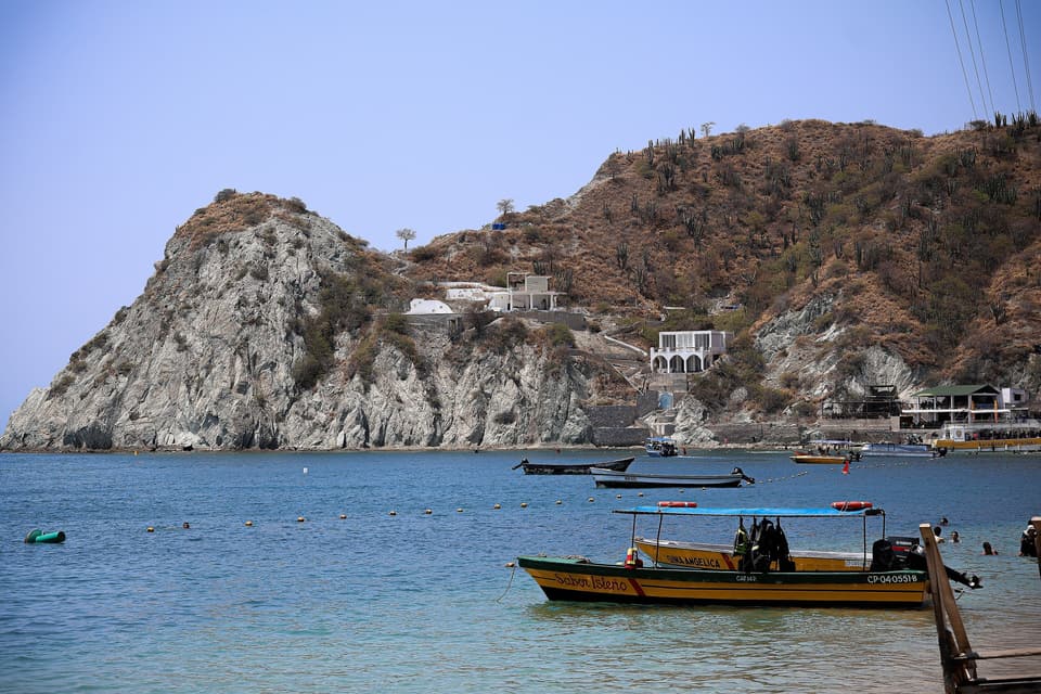
Taganga bay with fishing boats and dry hills.

Photo: Agpinzon01 · CC BY-SA 4.0 · Wikimedia Commons

7 Fishing village

Taganga

10 min by taxi

A fishing village on its own bay, among dry hills, a few minutes north of Santa Marta. Boats leave its beach for Playa Grande and, by sea, for Tayrona National Park.

Best time: Morning

  • Mornings usually bring calmer water and emptier boats.

Heads-up: Only take registered boats, and wear a life jacket.

For a full day

The Sierra and the park: leave early, return by evening.

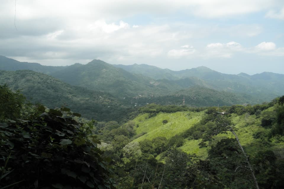
A view over Minca and the green mountains of the Sierra Nevada.

Photo: Stoni111121 · CC BY-SA 4.0 · Wikimedia Commons

8 Mountains, coffee and waterfalls

Minca

About 45 min by minibus from the Mercado Público (4 min by taxi from Musa)

A small mountain village about 21 km away in the Sierra Nevada foothills, cooler than the coast and surrounded by coffee and cacao farms. Short hikes lead to river pools such as Pozo Azul and the Marinka waterfalls; higher up, the Los Pinos area looks out over the Sierra to the sea.

Best time: From early morning

  • Leave early: from May to November it often rains in the afternoon.
  • For coffee and cacao there are tours with pick-up at the house (see tours).

Heads-up: Rivers rise fast after rain: avoid the pools during or after a storm.

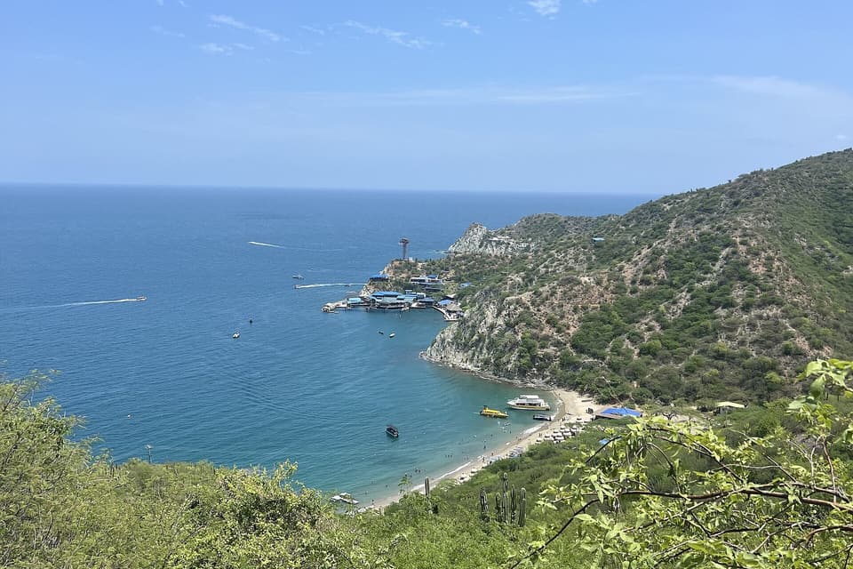
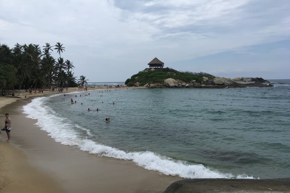
A view of Cabo San Juan del Guía in Tayrona National Park.

Photo: Santiago Augusto Páez Pulido · CC BY-SA 4.0 · Wikimedia Commons

9 National Natural Park

Tayrona National Park

About 45 min to the El Zaino gate along the Troncal del Caribe

Caribbean coast where dry forest, mangroves and reefs meet beneath the Sierra Nevada, sacred territory of the Kogui, Wiwa, Arhuaco and Kankuamo peoples. Most visitors enter at El Zaino and walk via Arrecifes to Cabo San Juan del Guía; Palangana reaches the calm bays of Neguanje, and Bahía Concha is the closest bay to the city.

Best time: December to April, the dry season

  • Tickets are sold at the gate on the day; accident insurance and the induction talk are compulsory.
  • Arrive at opening and plan your walk out before closing.
  • Annual closures (Respira Tayrona): 1–15 February, 1–15 June and 19 October – 2 November.

Heads-up: In 2026 the park closed a few times at short notice for weather or public-order reasons: check the official Parques Nacionales page the week you visit.

A multi-day adventure

Certified guides only.

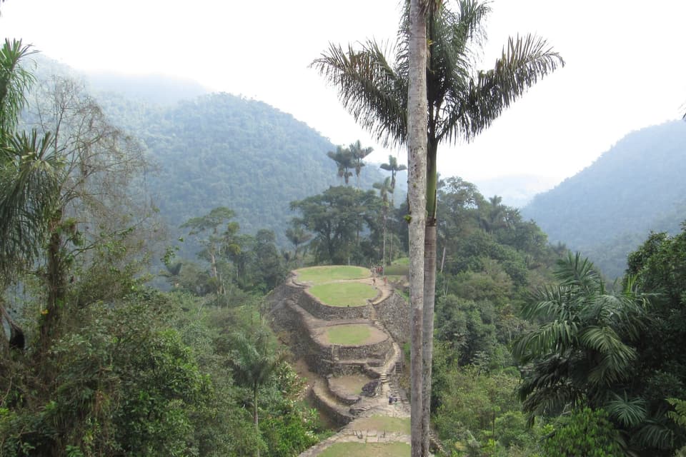
The stone terraces of the Lost City (Teyuna) in the Sierra Nevada forest.

Photo: Lilo2111 · CC BY-SA 4.0 · Wikimedia Commons

10 Multi-day archaeological trek

The Lost City (Teyuna)

An hour by road to Machete Pelao, then several days on foot, always with an operator

A Tairona city of stone terraces and stairways deep in the Sierra Nevada, reachable only on foot: several days from Machete Pelao through Kogui and Wiwa territory, crossing the Buritaca river. It's managed by ICANH.

Best time: December to March, the driest months

  • Only with a certified guide and an authorised agency.
  • There are seasonal closures: confirm dates with your operator and with ICANH.

Tours

Tours with partner operators.

Musa has a tour storefront on uTriper: each tour is run by its own agency (not the house) and booked right there, with its calendar. These are some of the ones listed, with the price shown on 22 October 2026.

  • Bike city tour of the Historic Centre

    COP 60,000

    Meeting point
    Rent Bike Santa Marta, Cra. 4 #19-12
    Duration
    2 hours
  • Minca: coffee and cacao tour

    COP 255,000

    Meeting point
    Hotel pick-up
  • Cabo San Juan, Tayrona

    COP 205,000

    Meeting point
    Hotel pick-up
    Includes
    Spanish-speaking guide, travel insurance, 4-hour hike
  • Playa Cristal, Tayrona

    COP 205,000

    Meeting point
    Hotel pick-up

    No hiking

  • Sailing day trip to Bahía Concha

    COP 236,000

    Meeting point
    Tayrona Sailing, Marina Internacional
  • Fun Dive

    COP 250,000

    Meeting point
    Marina Santa Marta, Carrera 1

    Without equipment; with equipment, COP 280,000

  • Minca 4x4: mountains, waterfalls and the Sierra

    COP 350,000

    Meeting point
    Santa Marta
  • Bike tour Taganga / Sisiguaca

    COP 350,000

    Meeting point
    Cra. 4 #19-12
    Duration
    8 hours
  • Tayrona Park (Colombian residents)

    COP 200,000

    Meeting point
    Carrera 1c #18-67
    Duration
    8 hours

    This price applies to Colombians only

  • Lost City trek, 4 days

    COP 1,860,000

    Meeting point
    Hotel pick-up
    Duration
    4 days
    Includes
    Local guide, translator and assistance insurance

Prices and availability can change: confirm on uTriper before booking.

Something tailored?

Reception will help you plan around your days, your pace and the weather.

Ask about tours (opens in a new tab)

Weather and seasons

  • Dry season runs December to April; the rainy season is May to November, peaking in September and October (IDEAM normals).

  • It's hot all year: average highs 31–34 °C. Head out early or late in the day.

  • Tayrona National Park has annual and sometimes unplanned closures: check the Parques Nacionales page the week you visit.

Destination photo credits

Photos from Wikimedia Commons under Creative Commons licences; they are not photos of Musa.

WhatsApp (opens in a new tab) Book